Spatial AI • Remote sensing • 3D reconstruction

Turning spatial data into decisions you can defend.

Satellite, drone and field data, turned into evidence — with the uncertainty measured and the limits stated.

What we have built

Built, not mocked up

Screens from the systems themselves.

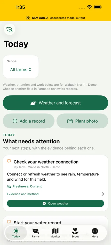
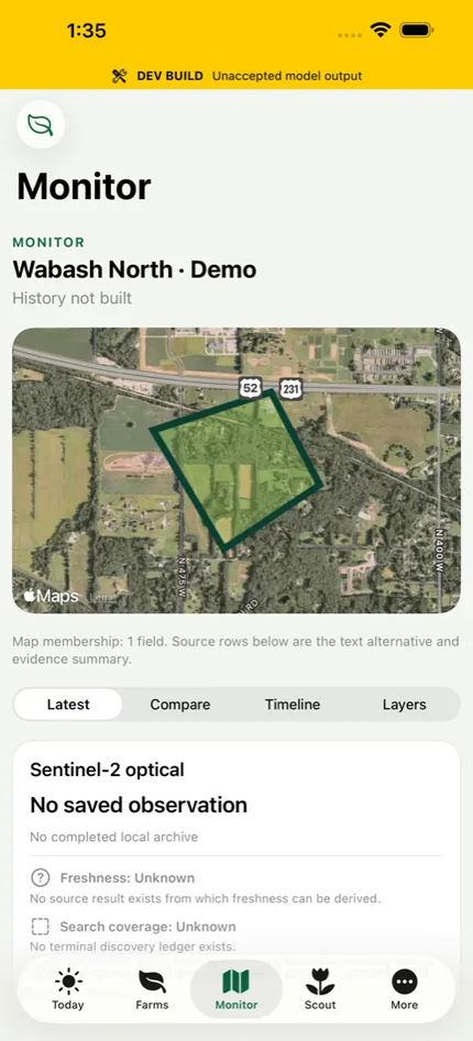
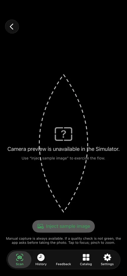
Phone apps, satellite reads and field records, stacked as they come. The yellow banner on the app screens is ours: it marks output that has not passed acceptance. The working versions are in the demos.

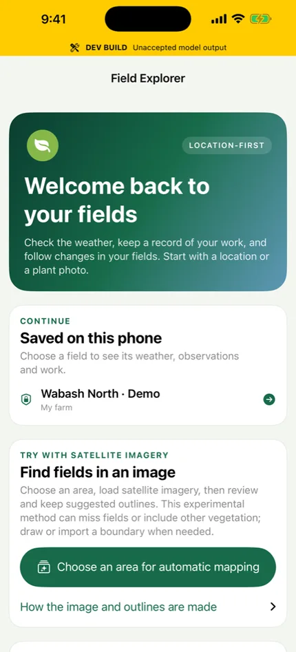
Field Explorer onboarding screen
Today screen: what needs attention, with the evidence behind each item
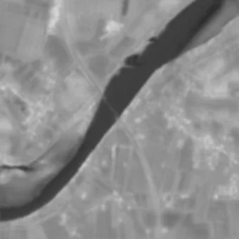
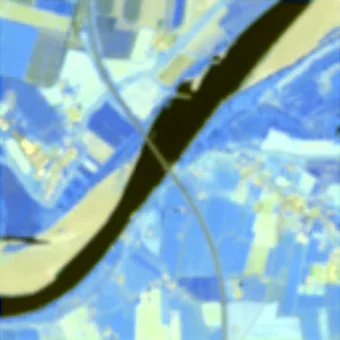
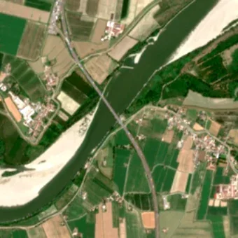
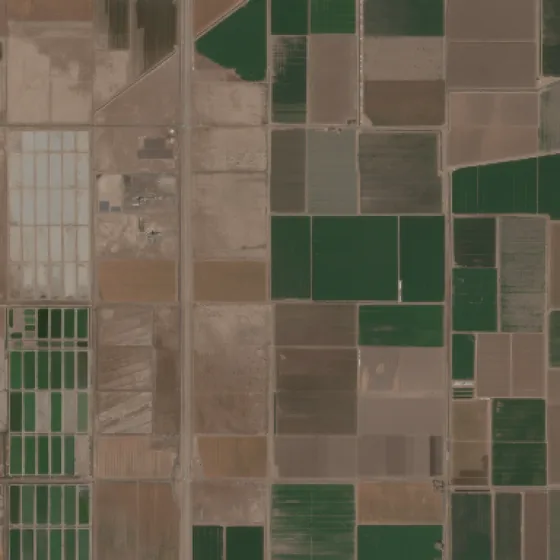
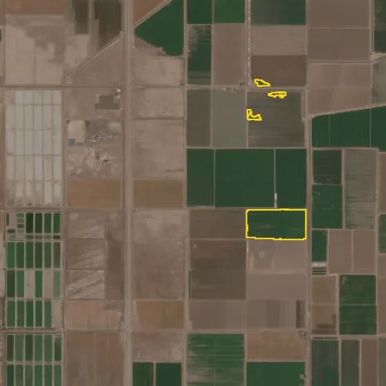
Sentinel-2 natural colour view of irrigated fields
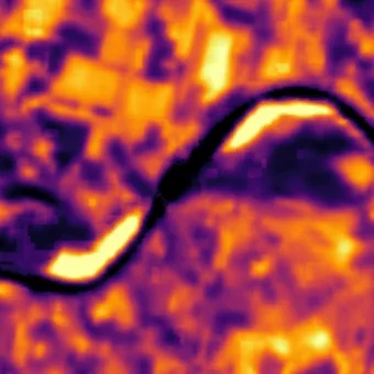
Monitor screen: one field's satellite record
FieldPatho Scout: the guided capture screen used to record a plant
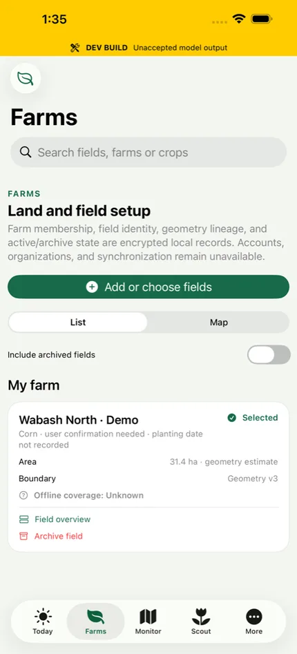
Farms screen: the fields a grower has drawn or imported
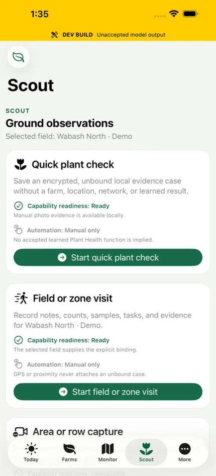
Scout screen: ground observations recorded offline
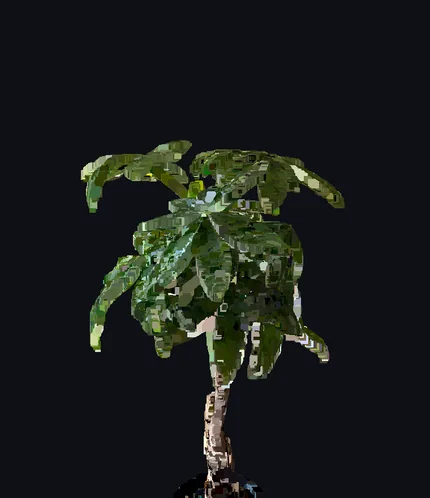
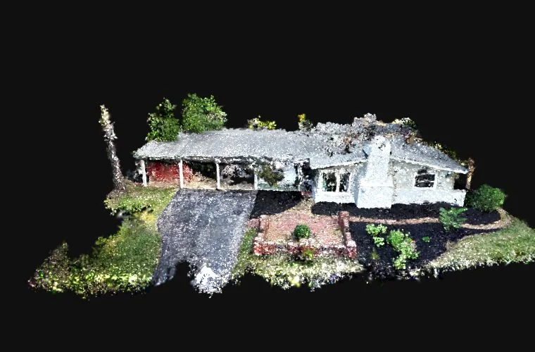
A plant reconstructed in 3D from a phone capture
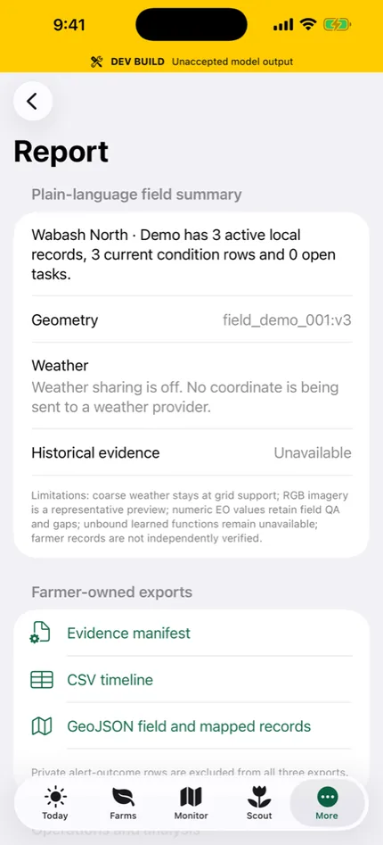
Reports screen
Detected field boundaries drawn over the same scene

What we build

Four working systems, each honest about its evidence.

Every product below is backed by a machine-readable evidence scorecard and independent review. We label maturity plainly — from interactive demos to early research — so you always know what is demonstrated versus what is still being validated.

R&D stage · real public-data benchmark Agriculture · breeding & trials

Digital Field Twin

A physics-informed crop genetics-×-environment decision model, benchmarked on real public breeding data (Genomes-to-Fields, SoyNAM, CIMMYT) with explicit uncertainty and abstention — not another green dashboard.

Explore Digital Field Twin →
R&D stage · honesty-gated Agriculture · crop scouting

FieldPatho

Field-first plant-disease intelligence for phones. Every result is labeled by how it was validated — on-device, backend, candidate, or reference — so a suspected match is never shown as a confirmed diagnosis.

Explore FieldPatho →
Interactive demo · audited V1 Remote sensing · imagery

ASI Prism

Physics-constrained ×4 super-resolution of free Sentinel-2 imagery, with hallucination-audited detail tiers and a measured low-frequency consistency guarantee. Generated detail is labeled as inference, never fact.

Explore ASI Prism →
Alpha · interactive 3D demo 3D reconstruction · digital twins

HouseTwin

Photoreal 3D reconstruction from ordinary phone capture — no survey scanner, no rig. Orbit a Gaussian-splat model of a real structure live in your browser. The same reconstruction core behind ASI Labs spatial twins.

Explore HouseTwin →

See it in action

Interactive research demos.

In-browser demos — no install, no login. They render precomputed model outputs and real 3D reconstructions on your own device. Detail that is inferred is labeled as inference, and the results that do not flatter us are shown too.

3D reconstruction · digital twin

HouseTwin — rebuilt from ordinary video

A garden and house front solved from phone video alone: no drone, no measured control points, no depth sensor. Beside it, a plant and a vehicle reconstructed on the phone itself in minutes, camera and LiDAR together. Every one is a dense field of colored splats you orbit in real time in WebGL2.

Orbit the 3D models →
Remote sensing · super-resolution

ASI Prism — physics-based spatial, spectral and multimodal inference

From a single Sentinel-2 view, generate a ×4 output whose fine detail is inferred, with selectable detail tiers — each output physically constrained where supported or clearly labeled as prediction.

Open the live demo →
Crop disease · abstention · 3D

FieldPatho — what it does, and where it fails

Three demos in one page: how often it is right on the crops it carries, what it does when it does not know, and a plant measured in 3D.

Open the demos →
Farming · satellite · live

Field Explorer — any farm, from space

Pick any point on Earth. It fetches the newest Sentinel-2 image, suggests field outlines and runs every model we have — each view labelled measured, derived or predicted, beside what a satellite cannot tell you. About a minute per run.

Work with us

From raw spatial data to decision-ready evidence.

Beyond the products, ASI Labs takes on focused engagements — the fastest way to put this capability on your problem.

01

Measurement Validation Sprint

A fixed-scope, 2–3 week engagement on your archived data: is an automated measurement accurate, repeatable, and faster than the current workflow? You get a pre-registered acceptance test and an auditable go / no-go.

02

Remote Sensing Analytics

Turn UAV, satellite, hyperspectral, multispectral, LiDAR, and SAR data into insight — crop health and stress, phenotyping and canopy analysis, and multi-temporal monitoring.

03

AI Product Prototypes

Credible first versions that connect models, dashboards, and decision workflows — evidence-gated, reproducible, and ready for pilots or grant submissions.
How we work

Small, senior, and evidence-first.

Every engagement moves from an unclear question to a working system — with the limits stated, not hidden.

1

Frame the decision

Define the operational decision, the user, the time horizon, and measurable success criteria before touching a model.

2

Audit the data

Assess sensors, resolution, coverage, labels, ground truth, and leakage — a cheap gate before any expensive work.

3

Build the intelligence layer

Develop models, pipelines, and evaluation that connect spatial signals to outcomes — with calibrated uncertainty.

4

Deliver the evidence

Package results into an auditable report, dashboard, or prototype — plus an independent review of the claims.

Start here

Have spatial data, a crop problem, or an AI product idea?

Send a short note about your goal, data sources, timeline, and the decision you want to improve. ASI Labs can help you shape the system and build the first working version.

Project inquiry

Best for validation sprints, prototypes, partnerships, and applied research collaborations.

Email ASI Labs ali@asi-labs.ai
Based in West Lafayette, Indiana Available for remote and hybrid engagements